The Panjkora River is a significant watercourse that winds through the mountainous landscape of the Khyber Pakhtunkhwa province in North-Western Pakistan. This river plays a crucial role in shaping the region’s geography, culture, and ecology, flowing through the stunning Kumrat Valley before merging with the Swat River at Chakdara. However, the Panjkora River’s story is one of both natural beauty and environmental neglect.
In its pristine state, the Panjkora River was celebrated for its crystalline waters, which meandered gracefully through the picturesque landscape. This icy haven was home to a diverse array of fish, particularly species of trout, which thrived in its clean and unpolluted environment.
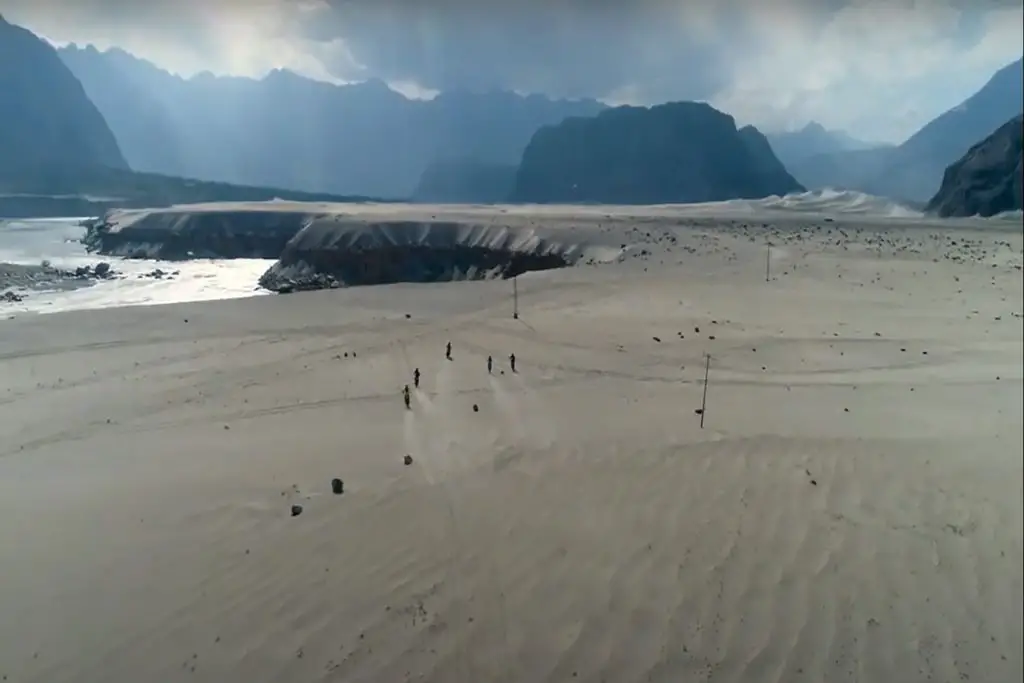
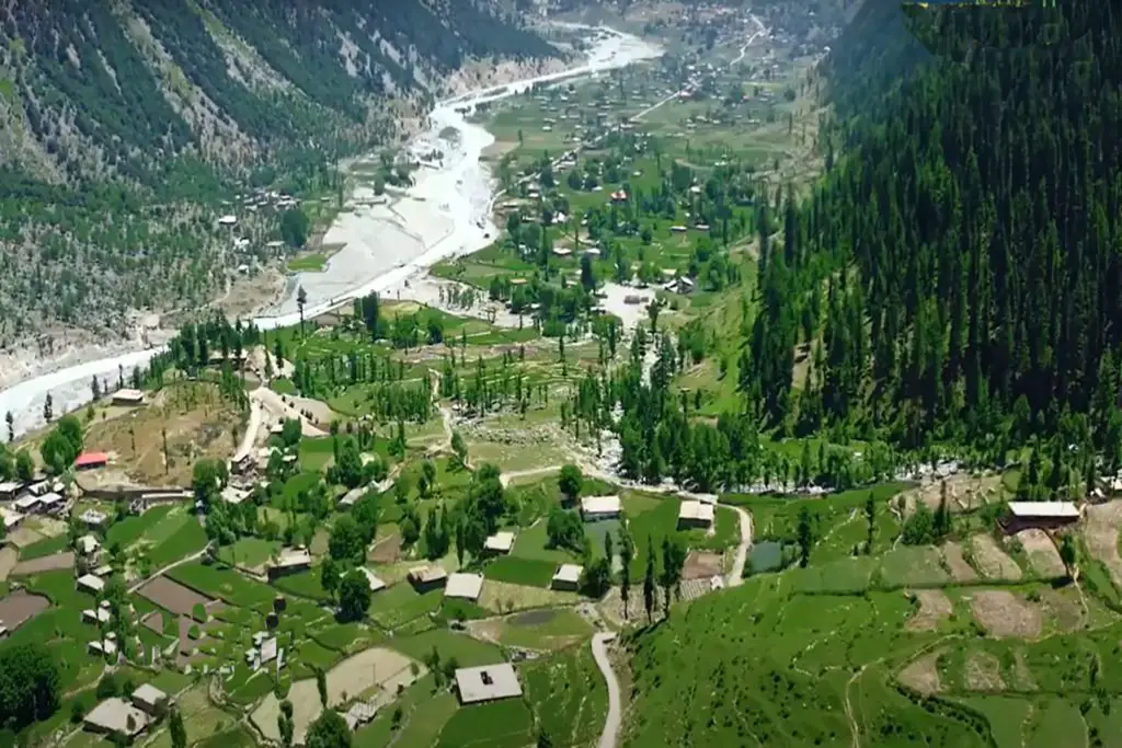
Originating from the lofty heights of Kumrat, nestled in the majestic Hindukush mountain range, the Panjkora River carved a 220-kilometer path. As it flowed through the awe-inspiring Kumrat Valley, Dir Upper, and Dir Lower districts, it unveiled its natural grandeur, capturing the hearts of locals and visitors alike. Finally, the river converged with the mighty River Swat in Matkani, Malakanad, creating a harmonious union of waters.
However, the Panjkora River’s current condition paints a somber picture. Instead of flowing freely with pristine waters, it now grapples with a severe predicament. Negligence, whether by individuals or authorities, has led to the indiscriminate dumping of solid waste, gutters, and untreated wastewater into its once-glistening depths.
This alarming situation not only tarnishes the river’s natural beauty but also poses a substantial threat to water quality. Unfortunately, this looming catastrophe often goes unnoticed, failing to garner the attention it desperately warrants.
It’s important to note that the name “Panjkora” has Persian origins, with “Panj” meaning “five” and “Kor” signifying “flowing water.” This name stems from the fact that five streams combine in the mountains to form this river. In ancient times, this mountainous track was part of the Silk Route, used for trade between Punjab in India and Kashghar in China. During the British Raj, modern roads replaced this historic trade route.
Until the 1970s, the Panjkora River’s waters remained clear of pollution and were even used for drinking. Along its banks, there are still 130 water mills in operation.
The river’s total water flow ranges from 15,000 to 20,000 cusecs, with each tributary contributing around 3,000 to 5,000 cusecs of water. During the devastating floods of 2010 and 2022, the water levels surged to a staggering 160,000 cusecs, resulting in widespread destruction of human settlements along its banks.
Geographically, the Panjkora River is situated within the larger Swat River Basin, part of the Khyber Pakhtunkhwa province in northwest Pakistan. The main tributaries of the Panjkora River include Rivers Dir, Barawal, Kohistan, and Usherai. Water flow occurs year-round, but during the monsoon season (June-September), water levels dramatically rise. The mouths of the tributaries see even more substantial water flow during this season, often leading to destructive floods.
One pressing environmental concern is bioaccumulation, where species absorb substances faster than they can expel them. This issue has led to increased toxic metal accumulation in fish species in the Panjkora River. Metal content in fish tends to rise as one moves closer to the river’s mouth, primarily due to agricultural practices and sewage dumping.
Agriculture is a major industry supporting the communities along the river. However, it has downsides, particularly during heavy rainfall when substantial runoff carries soil, animal waste, and fertilizers into the river. This influx floods the river with lead (Pb) and nickel (Ni), with Ni increasing significantly closer to the river’s mouth. Marble industry effluents are another substantial source of Ni contamination. Although the contamination of heavy metals has not yet become a severe health issue, scientists warn that continued bioaccumulation could pose significant risks to the environment and human health.
Natural disasters in the Panjkora basin are heavily dependent on the season. The monsoon season brings significant downpours (June-September), causing severe floods in the region. The region’s topography magnifies the impact of rainfall, particularly in the low-lying areas near the base of the mountains. Approximately 15% of the Panjkora basin is classified as highly prone to flooding, putting lives and fertile farmland at risk.
Farmers along the river rely extensively on the rich alluvial soil offered by the floodplains. However, poor education and management practices often leave the soil fallow for part of the year. Heavy rainfall leads to substantial runoff, carrying lead (Pb) and nickel (Ni) from the soil, animal waste, and fertilizers into the river.
The Panjkora River stands as both a lifeline and a potential threat to the communities it nurtures. Its preservation and sustainable management are critical to ensure the continued well-being of the region and its people.