Babusar Top is a scenic mountain pass located in the Kaghan Valley of Pakistan, at an elevation of 4,173 meters above sea level. The pass connects the Kaghan Valley with the Chilas district and is a popular tourist destination, known for its stunning natural beauty and breathtaking views. This article describes in detail about visit to Babusar Top including Babusar Top height and weather.
At the top of the Babusar, is a bridge like a stone minaret, which is a symbol of the highest point in the area. On the right are the snow-capped peaks of Kashmir, while to the northeast there is an interesting view of Nanga Parbat. From the pass, the entire panorama stretches out in front of the visitor.
The views from the top are truly breathtaking. Clouds that used to appear on mountaintops now surround you. Looking down from the top, you can see a spectacular road that twists and turns through the mountains. On a clear day, the great Nanga Parbat (26,660 feet) can also be seen from here.
It used to be known as Babur Top because the same route was used by the famous Mughal Emperor Babur in the early 16th century, which is one of the reasons for its success as a tourist attraction.
Babusar Top Height and Weather
The Pass is a high mountain pass at an altitude of 4,179 m (13,710 ft) above sea level, located on the border between the Khyber Pakhtunkhwa and Gilgit-Baltistan provinces of Pakistan. It is one of the most hairpin roads in the world.
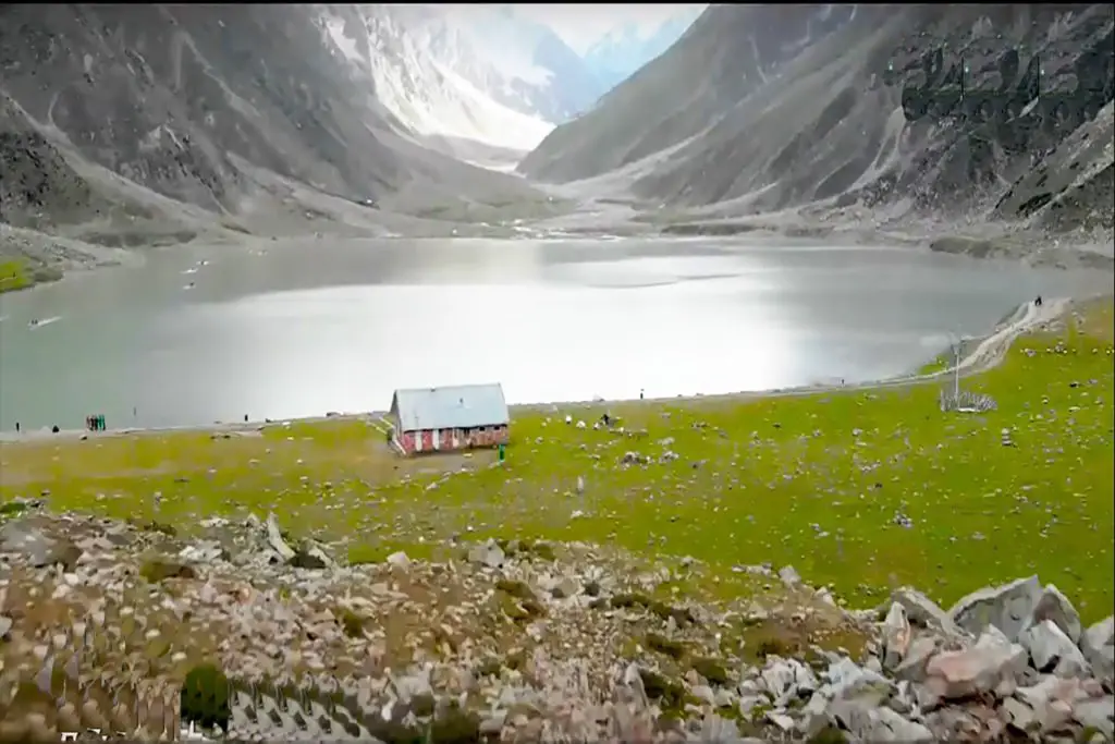
Babusar Top is surrounded by majestic snow-capped mountains, including the Himalayas and the Karakoram range. The pass is also home to several glacial lakes, streams, and waterfalls, which add to the beauty of the landscape. It is also an important stopover for trekkers and hikers who use it as a base camp to explore the surrounding mountain trails.
Where is Babusar Pass?
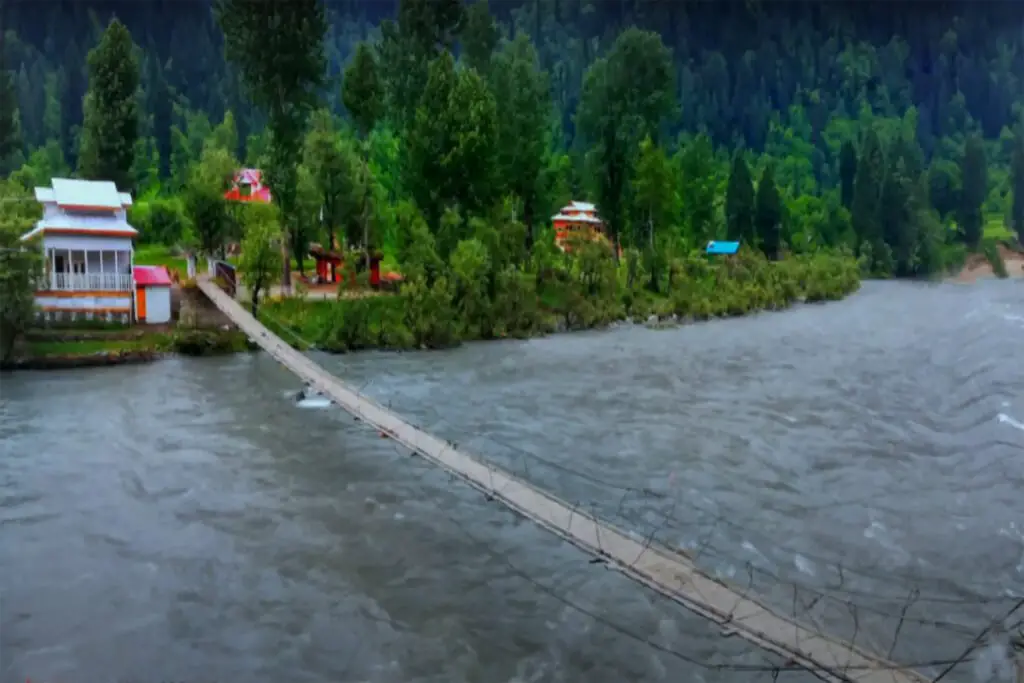
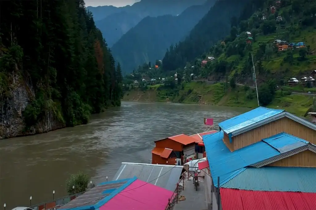
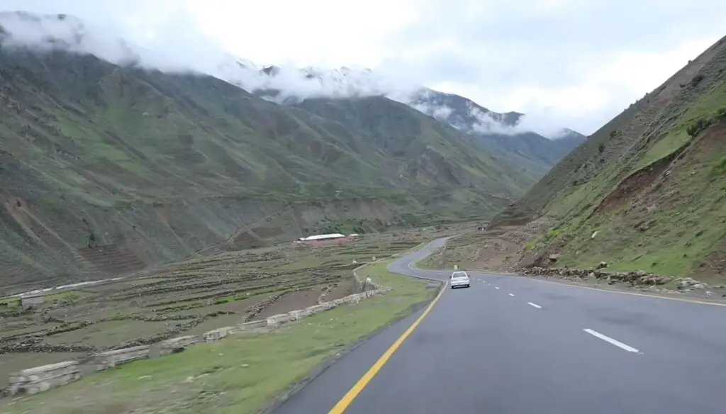
The pass connects the Kaghan Valley via Thak Nala with Chilas on the Karakoram Highway. The pass is at a distance of 80 km from Naran. It is on the way to the pass that the scenery of the Kaghan Valley becomes most dramatic. The area has been a popular tourist spot over the years with a number of nearby attractions.
Apart from its natural beauty, Babusar Top is also an important trade route between Pakistan and China. The construction of the Karakoram Highway, which connects Pakistan with China, has made the Babusar Top an important hub for commercial and tourist traffic. The pass also serves as a link between the Gilgit-Baltistan region and the rest of Pakistan.
Access to Babusar Top
The Babusar Top is accessible from both the Kaghan Valley and Chilas, with the journey from either side offering its own unique set of views and landscapes. The journey from Kaghan Valley to Babusar Top is especially scenic, with travelers passing through lush green forests, pastures, and meadows, and getting a glimpse of the local wildlife such as ibex, markhor, and snow leopards.
Best time to Visit Babu Sar Top
The best time to visit Babusar Top is from May to September, as the pass is closed during the winter months due to heavy snowfall. During the summer months, the Pass is covered with wildflowers, and the surrounding meadows are a popular spot for picnics and camping.
Can a car go to Babusar Pass?
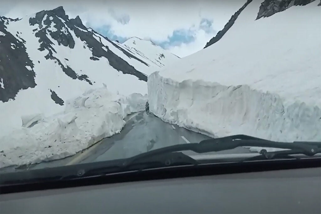
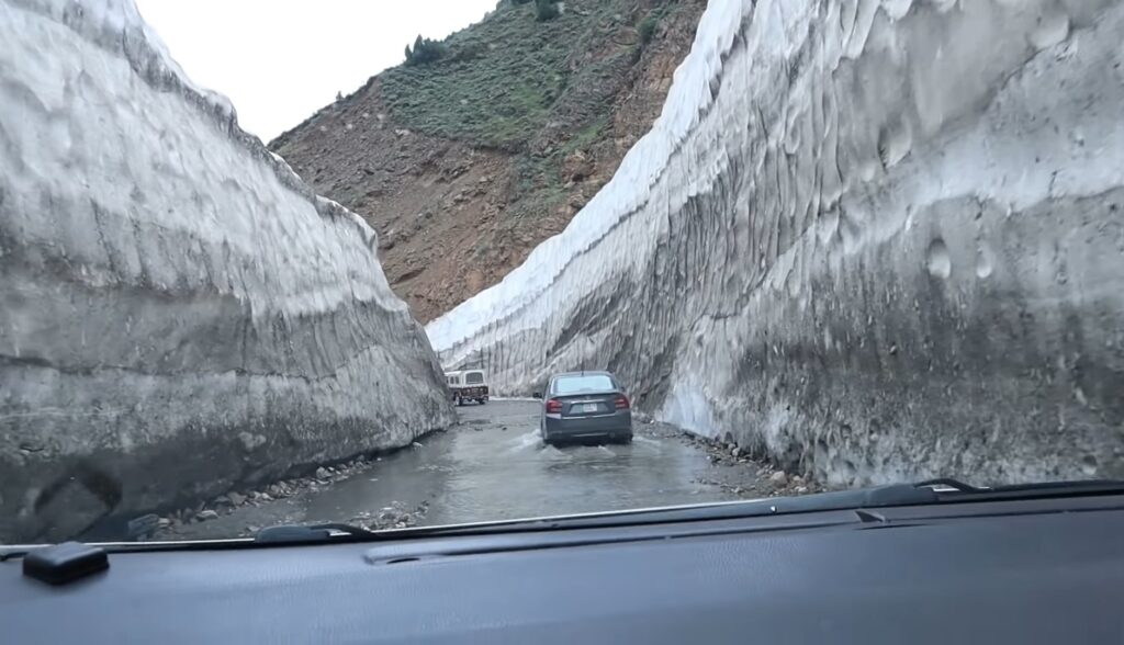
The road to the top, also known as Babusar Top, was recently paved. Due to the unavailability of the necessary facilities, it is necessary to take food and necessary things with you. The road is wide and usable for all types of vehicles. It is a typical Pakistani mountain road with hills on one side and a deep khud (valley) on the other.
Although there are efforts to upgrade the road, the most progress has been made on the Chilas side. Before crossing the Babusar Pass, you should definitely get advice from the locals. The PTDC in Naran is a good resource; in Chilas, try field officers in the office of the Executive Engineer of NAPWD (Northern Areas Public Works Department) or Natco drivers on the run of Babusar village.
The pass road was first built by the British as an alternative route to connect the Gilgit Region with British India. Many deaths occur here every year due to the mountain slopes, which are among the most dangerous in the world.
The most common cause of death is car brake failure due to inexperience. Towards the top of Babusar Pass, the turns become sharper and steeper. Make sure the brakes, exhaust systems, and heaters are in good working order.
How long is Babu Sar Pass?
The road to the top is called National Highway 15 (N-15). The road is 226 km (140 mi) long and runs south-north from Mansehra (capital of Mansehra District in Khyber Pakhtunkhwa Province) to Chilas (divisional capital of Diamer District in Gilgit-Baltistan).
Is Babusar Pass open?
The pass is always covered with snow, but in the summer the snow melts, so the roads are loose and it usually rains there. From mid-July to the end of September, the road beyond Naran is open up to Babusar Pass. However, movement is restricted during the monsoon and winter season but may be closed anytime when there is no access from snow.
A cold wind blows all the time. Kaghan Valley is at its best in summer (May to September). In May, the maximum temperature is 11 C (52 F) and the minimum temperature is 3 C (37 F). Security officials may stop you from crossing Babusar Pass after 5:00 PM PST, so make sure you arrive at the Babusar Pass before that time.
The Babusar Pass, which holds the title of the highest peak in the Naran Valley, is elevated at a height of 13,691 feet. It is a connecting mountain that connects Kaghan with Gilgit-Baltistan via Chillas. Babusar Top is known for providing easy access to its visitors through regular four-wheelers. Conversely, Babusar Top is considered one of the most dangerous mountain slopes. It is therefore necessary to ensure all safety measures for this adventurous ride.
Movement towards Babusar Top is restricted to the monsoon and winter season. However, it is completely accessible and suitable to visit from May to September. The temperature during May ranges from 11°C to 3°C. There are no hotels at the top of Babusar. Therefore, it would not be wrong to say that Babusar Top is the best place to visit but not to stay.
Babusar Top is a place for nature lovers as it offers a wide variety of plant and animal species. Snow pigeons, owls, snow grouse, and hawks can be found in the nearby beautiful pine and oak forests. Sheep and wild goats are abundant in the area, but cultivation is a challenge due to the harsh weather conditions and high altitude.
People of Babusar
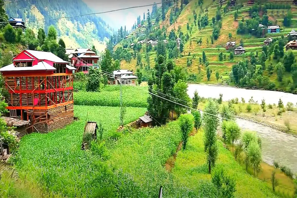
Babusar Top is not habitable due to its height, but there are traces of habitat in the adjacent village of Jhalkad. The lower sides of the Naran Valley are home to Gujjars and other migrants in the summer to graze their cattle.
Hotels and Restaurants
Babusar Top does not offer an extensive variety of food and does not have any large fancy restaurants. However, they never return anyone with an empty stomach. At the top, tourists can always have Chana chat, corn on the cob, tea, and other local snacks.
In conclusion, Babusar Top is a beautiful and picturesque mountain pass, that offers breathtaking views of the surrounding landscape. Its natural beauty and strategic location make it an important tourist destination and a crucial trade route between Pakistan and China. A visit to the Babusar Top is a must for anyone looking to explore the beauty of Pakistan’s northern areas.