The Nanga Parbat base camp trek is an really adventurous tour of the Himalaya region of Pakistan. More recently, it has become a popular destination for Pakistani hikers and hikers from all over the world.
Summer is considered to be the best hiking season in the Himalayan and Karakoram Regions in Pakistan.
Most Amazing Journey – Nanga Parbat Base Camp Trek
The Nanga Parbat Base Camp Trek is undoubtedly one of the most amazing journeys in the world. Nanga Parbat is the ninth highest mountain in the world and the second largest in Pakistan after K2. It is located in the Diamir region of Gilgit Baltistan, Pakistan.
Nanga Parbat is situated in the western part of the Himalayas, demarcated from the Karakoram range by the formidable Indus River, which flows directly from the Indus valley. The awe-inspiring and magnificent Fairy Meadows, coupled with a drive along the renowned Karakoram Highway, renders the Nanga Parbat camping expedition a truly exceptional trekking experience.
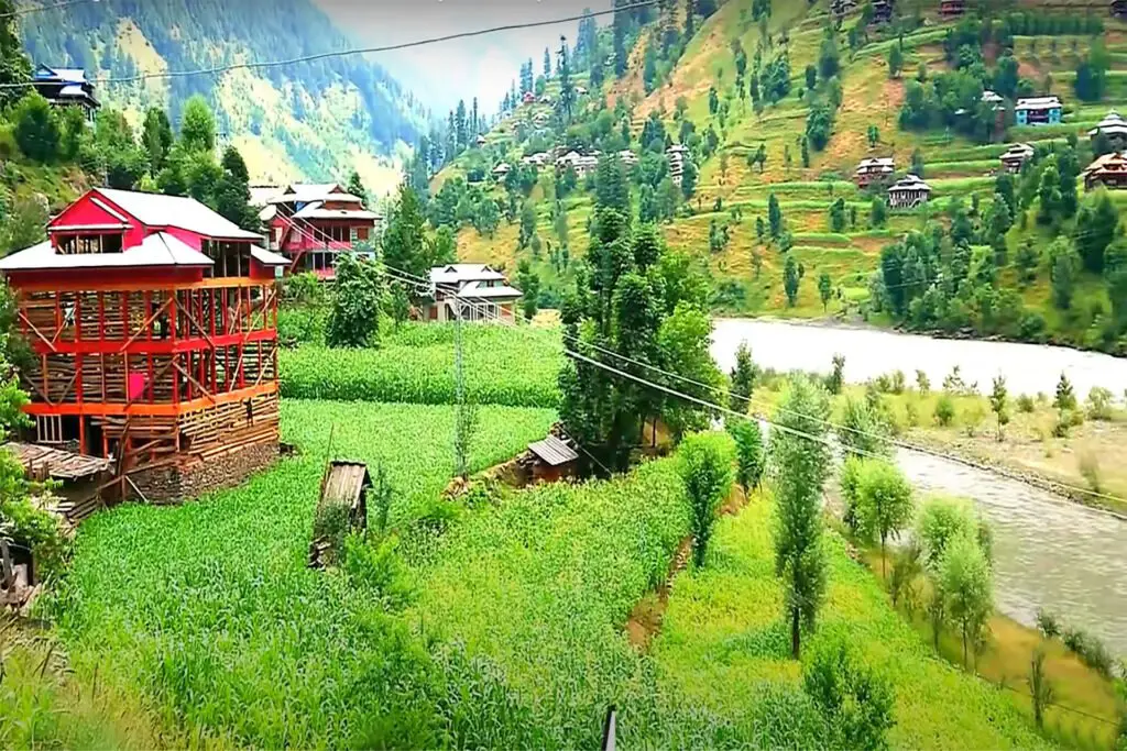
This trek leads you through lush, verdant, and steep slopes adorned with cascading waterfalls in the western Himalayas. Fairy Meadows, an iconic natural wonder in Pakistan, stands out for good reason. This picturesque alpine terrain is nestled in a breathtaking backdrop, dominated by the imposing Nanga Parbat, the 9th highest peak globally, which draws visitors from far and wide.
History of Nanga Parbat Base Camp Trek
Nanga Parbat is not a solitary Peak but rather comprises an extensive series of peaks and hills spanning approximately 20 kilometers, ultimately culminating in a snowy summit that reaches 8,125 meters in elevation. The southern side of this mountain is famously known as the Rupal Face, which descends to an altitude of about 5,000 meters. On the other hand, the northern side, the Raikot Face, plunges over 7,000 meters from the summit down to the Indus River, forming one of the deepest ravines on the planet.
This formidable peak first captured the attention of mountaineers in 1953 when an Austrian-German joint expedition tackled its ascent. Hermann Buhl made a remarkable solo climb that lasted for an exhausting 41 hours. In 1970, the Italian mountaineer Reinhold Messner ascended the southern face, the Rupal Face, while his brother Gunther descended via the Diamir route.
The southern face of Nanga Parbat is the most extensive of its kind globally, extending for over four miles (approximately 4 kilometers) above the base camp. To date, only five successful ascents have been made from the southern side.
Islamabad to Nanga Parbat Base Camp Trek
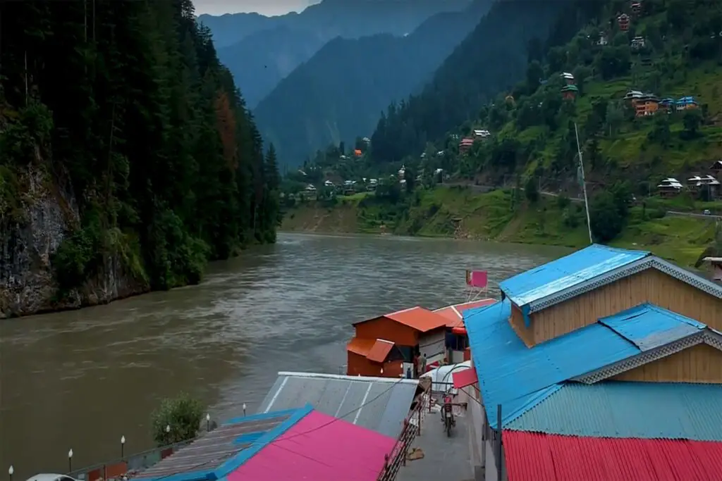
Tourists embarking on this adventure will drive along the Karakoram Highway to reach Chilas. Along the way, they’ll pass through various towns and regions, including Abbotabad, Mansehra, Besham, Dasu, and Sazini, before finally arriving in Chilas City.
To venture from Chilas to Fairy Meadows, a 2-3 hour journey is required in a 4×4 Jeep. Once at Fairy Meadows, visitors have the opportunity to unwind, meander through the beautiful surroundings, partake in short walks, or engage with the local residents.
The jeep ride to Fairy Meadows is an experience in itself. This thrilling excursion includes a daring two-hour drive along what is widely regarded as one of the world’s most treacherous roads. The road is predominantly narrow, winding, and marked by steep drops alongside a stunning canyon. What adds to the challenge is that the road is only wide enough for a single jeep, yet it accommodates traffic moving in both directions, making passing other jeeps quite a demanding task.
It’s important to note that, despite the enchantment of Fairy Meadows, this journey might not be suitable for individuals uncomfortable with perilous routes, fearful of heights, or averse to danger. Many travelers choose to stay at Fairy Meadows and forgo the onward journey.
Nevertheless, for those who are up for the adventure, a day trip from Fairy Meadows to Nanga Parbat Base Camp is a worthwhile pursuit. The views are nothing short of spectacular, with the northern face of Nanga Parbat appearing impressively close and captivating.
Route from Fairy Meadows to Nanga Parbat Base Camp
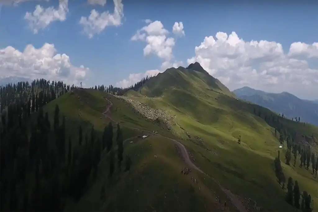
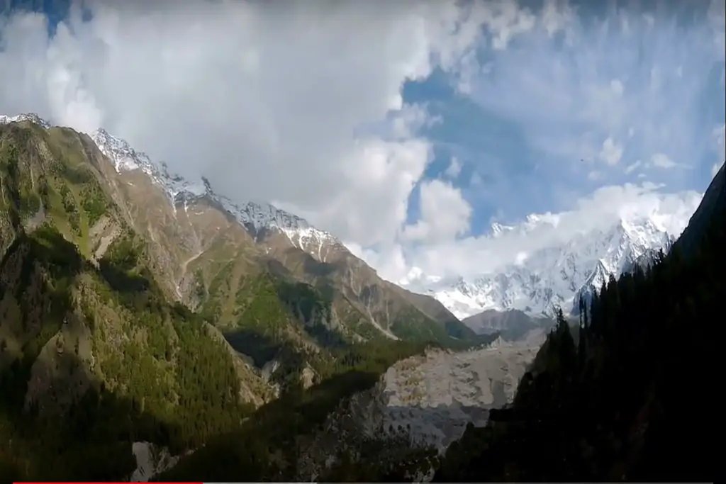
A short distance beyond Fairy Meadows, you’ll encounter a second campsite known as Beyal, offering tranquility and even more impressive vistas than the previous camp. As you continue beyond Beyal, the trail becomes more challenging but equally rewarding. Transitioning from the mountain’s lush forested areas, the trail evolves into an almost desert-like terrain, with awe-inspiring snow and ice surroundings.
Leaving Fairy Meadows, the path leads through a forest perched high on the hillside along the western bank of the Raikot Glacier, providing several glimpses of the mighty Nanga Parbat in the distance. After approximately 60 minutes of walking, you’ll arrive at the outset of Beyal Camp. Beyal Camp is a small village where locals have established a restaurant, a few cabins, and a campsite. While Beyal Camp lacks electricity, it compensates with solitude and serenity, making it an appealing alternative to Fairy Meadows for some.
The Beyal Camp sprawls along the valley, requiring about 15 minutes to explore on foot. Continuing beyond Beyal Camp, the trail meanders through sparse trees with an easily discernible path and only a slight uphill gradient. After roughly 45 to 60 minutes, you’ll reach a viewpoint overlooking the Raikot Glacier. This viewpoint affords breathtaking vistas along the glacier and towards prominent peaks, including Nanga Parbat (8,126m), Chongra Peak (6830m), Raikot Peak (7070m), and Ganalo Peak (6606m). The viewpoint often sees visitors taking a break, enjoying snacks, and, in some cases, many opt to turn back towards Fairy Meadows from this point.
Participants will continue walking for a few hours, eventually reaching the Nanga Parbat Base Camp, where silence is occasionally interrupted by distant sounds of avalanches. Here, you’ll spend the night beneath the shadow of the Himalayan giant (8,126m).
Upon leaving the Raikot Glacier Viewpoint, the trail conditions transform significantly. Instead of winding through thick vegetation, you’ll traverse the edge of a snowy valley. This section involves a narrow path situated on a steep incline compared to the previous part of the trail, yet it isn’t particularly dangerous or technically advanced (assuming you’re traveling when there’s no snow). This part of the trail is also more exposed without tree cover, making it quite evident.
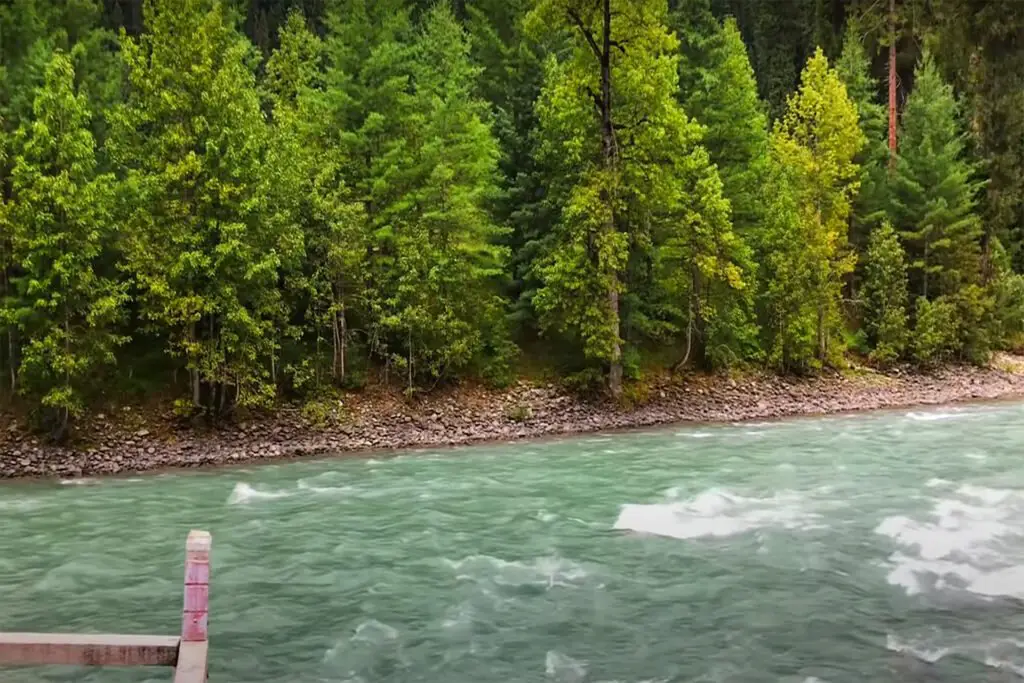
Throughout this section, you’ll encounter several stream crossings, which, even during late summer, can be challenging. Fortunately, locals have constructed makeshift bridges to help navigate these streams, even though they may not appear entirely sturdy.
After approximately 60 minutes of hiking, you’ll come upon a rocky outcrop, followed by an up-and-down ascent along a steep slope in a grassy area, which takes another 15-30 minutes. In total, the hike from the Raikot Glacier Viewpoint to the base camp or tuck shop should take around 90-120 minutes. Many trekkers opt to stop at the tuck shop, which offers a fantastic view and serves chai and dahl, making it a convenient place to rest and turn back.
It’s worth noting that some maps may depict the Nanga Parbat Base Camp at a slightly different location from the tuck shop, and there are two basic camps – one for winter and another for summer.
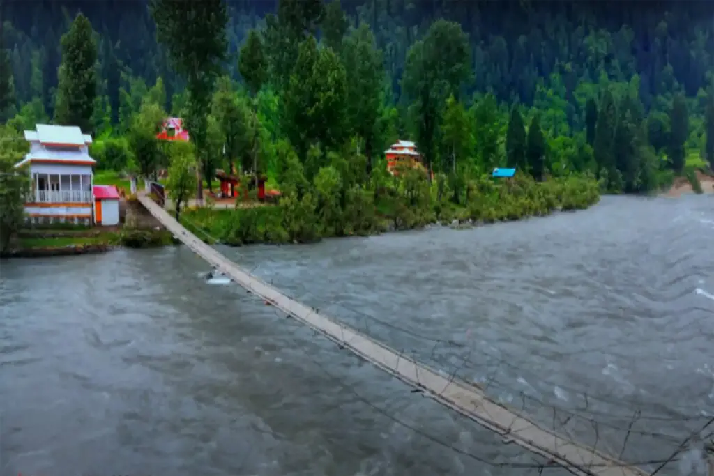
Numerous private lodging options are available, primarily in Fairy Meadows, including cabin-style accommodations and camping spots. Beyal Camp, located about a 45-minute walk past Fairy Meadows, also provides cabin and camping options.
The return journey takes you back to Fairy Meadows, where you’ll have a full day to savor the enchanting surroundings. You can use this time for journaling, drawing, painting, relaxation, or capturing photographs of the majestic mountain at various times of the day, such as sunrise, sunset, and the full moon, each casting its unique charm upon the meadows of myth.
Subsequently, visitors will return to Besham or Naran, depending on weather conditions and the specific itinerary. If the route leads to Besham, it entails passing through Chilas and Dassu alongside the Indus River on the Karakoram Highway.
Summary of Nanga Parbat Base Trek Journey
- Raikot Bridge to the road near Tattu Village: 90-120 mins jeep ride.
- Trailhead to Fairy Meadows: 90-120 minutes steep climb (carriers and horseback riding available).
- Fairy Meadows to Beyal Camp: 60-90 minutes for easy navigation.
- Beyal Camp to Raikot Glacier Viewpoint: 60 minutes of easy navigation.
- Raikot Glacier Viewpoint to Nanga Parbat Base Camp: 90-120 minutes of moderate walking (some narrow sections on the road, and the last 30 minutes are steep).
Height of Nanga Parbat Base Camp
Height of Nanga Parbat Base camp is 3,850 meters or 12.631 feet.
Time required to Reach Nanga Parbat Base Camp
Its an 8 hour trek (round trip) to reach Nanga Parbat Base Camp from Fairy Meadows.