The Sulaiman Mountain Range or Sulaiman mountains, also known as Kōh-e Sulaymān, is a north-south extension of the southern Hindu Kush mountain system in Pakistan and Afghanistan. They rise to form the eastern edge of the Iranian Plateau.
The Sulaiman Mountain Range is a significant geological feature in Afghanistan and Pakistan, spanning over 600 km from the Khwaja Amran Mountains in northeastern Afghanistan to the Makran coastal region in southwestern Pakistan. The range is located to the east of the Indus River and stretches from the northern Khyber Pakhtunkhwa province of Pakistan to Balochistan in the south.
The mountains are bordered to the east by the plains of the Indus River valley, and to the north by the arid highlands of the Central Hindu Kush, which reach heights of up to 3,383 meters (11,099 ft). Together with the Kirthar Range on the Balochistan–Sindh border, the Sulaiman Range forms what is known as the Sulaiman-Kirthar Geological Province.
The Sulaiman Mountain Range is rich in natural resources, including gas and oil reserves, coal deposits, and minerals such as chromite, copper, and iron. The mountains also serve as an important watershed for the region, providing water for agriculture, industry, and domestic use.
Location of the Sulaiman Mountain Range
The Sulaiman Mountain Range is a major geological feature of Pakistan and one of the border ranges of the Indian subcontinent. The Sulaiman Range to the north borders the arid highlands of the Hindu Kush, where more than 50 percent of the land lies above 6,500 feet (2,000 m).
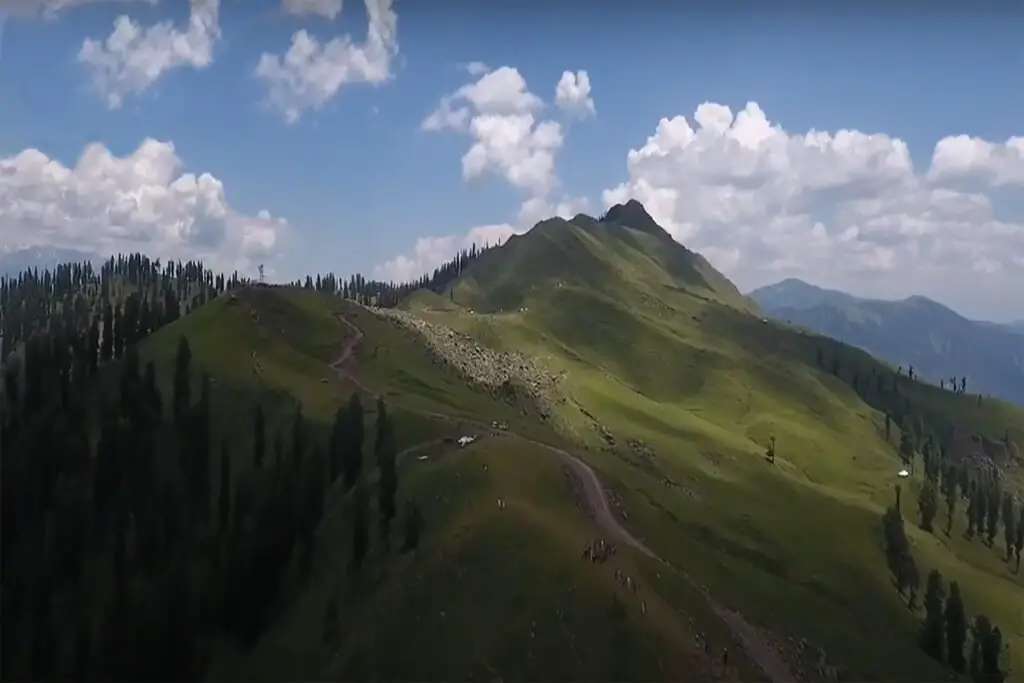
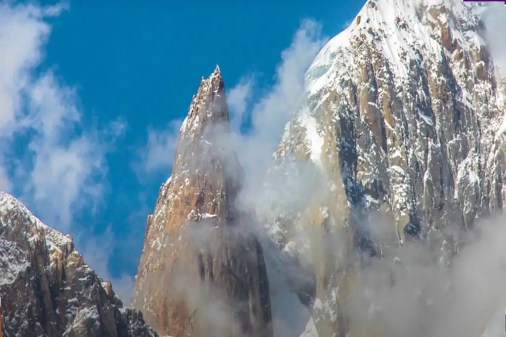
The most famous peak of the Sulaimans is the twin-peaked Takht-e-Sulaiman or “Solomon’s Throne” at 3,487 meters (11,440 ft), located near Darazinda in the Dera Ismail Khan sub-district, near the border with both South Waziristan and Zhob district of neighboring Balochistan province.
However, the highest peak is Zarghun Ghar at 3,578 meters (11,739 ft) near Quetta, Pakistan. The next highest peak in Balochistan province is the 3,475-metre (11,401 ft) Khilafat Hill, located in Pakistan’s Ziarat District and famous for the Ziarat Juniper Forest, where Juniperus macropoda trees grow.
Sulaiman Range, a mountain range in central Pakistan, extending south for about 280 miles (450 km) from the Gomal Pass to north of Jacobabad, separating Khyber Pakhtunkhwa and Punjab from Balochistan.
Its heights gradually diminish towards the south, the peaks averaging 1,800–2,100 meters, the highest being the twin peaks (30 miles [48 km] from the Gumal Pass) called Takht-i-Sulaiman, or Solomon’s Throne. which legend connects with Solomon’s visit to Hindustan; the higher of the peaks, at 18,481 feet (5,633 meters), is a site of ziyārat (shrine) visited by many pilgrims every year.
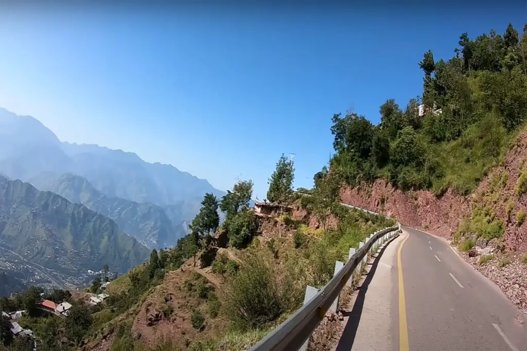
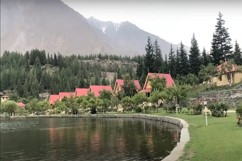
The eastern face of the range descends steeply to the Indus River, but in the west the range descends gradually. Juniper and Scotch pine are abundant in the north and olives in the center, but vegetation is scarce in the south. Ghat, Zao, Chuhar Khel Dhana and Sakhi Sarwar are the main passes in the north. To the south, west of Dera Ghazi Khan, lies the hill station of Fort Munro (6,303 feet [1,921 metres])
History of Sulaiman Mountains
Sulaiman Mountain Range has a long and complex history, having been inhabited by various groups of people for thousands of years. The earliest known human settlement in the area dates back to the Stone Age, with evidence of Paleolithic and Mesolithic cultures found in the region.
In ancient times, the Sulaiman Mountain Range served as an important trade route connecting the Indian subcontinent with Central Asia and beyond. The mountain passes were used by caravans transporting goods such as spices, textiles, and precious metals. The strategic location of the range also made it a site of frequent military conflict, with various armies using it as a natural barrier and defensive position.
Throughout history, the Sulaiman Mountain Range has been a place of cultural and religious significance. The region is home to numerous archaeological sites, including ancient cities, forts, and temples. The Buddhist monastery of Takht-i-Bahi, located near the town of Mardan in Khyber Pakhtunkhwa, is a UNESCO World Heritage Site and a testament to the region’s rich Buddhist history. The site includes the remains of a monastic complex dating back to the 1st century BCE, with well-preserved stupas, shrines, and living quarters.
In addition to Takht-i-Bahi, the Sulaiman Mountain Range is home to other important historical sites such as the fortress of Bala Hissar in Peshawar, the ruins of the ancient city of Taxila, and the ancient Buddhist stupa at Shahbaz Garhi. These sites offer a glimpse into the rich cultural heritage of the region, and attract visitors from around the world who come to explore the history and natural beauty of the Sulaiman Mountain Range.
Which is the highest peak of Sulaiman?
Zarghun Ghar is the highest peak in the Sulaiman Mountain Range, with an elevation of 3,578 meters (11,739 feet) above sea level. It is located near Quetta in the Balochistan province of Pakistan.
Features & Significance of Sulaiman Mountain Range
The Sulaiman Mountain Range is a north-south extension of the Hindukush mountain system. It forms the eastern border of the Iranian Plateau and the northeastern border of the Baluchistan Plateau.
A distinctive feature of the Sulaiman Mountain Range Alpine Meadows ecoregion is the enormous sense of space in these rugged mountains. Vegetation is sparse; but the vegetation community has a high level of endemism with species restricted to this range or parts of it.
For example, the Chitral Valley at the westernmost extreme of the Himalayas has 39 endemic plants, while the Toba Kakar Highlands further south, where the Himalayas curve south as the Sulaiman Range in the Balochistan region of Pakistan, has 31 endemic plants. The oldest forests of Pashtun juniper, now lost to firewood harvesting, are located on the higher peaks of this ecoregion, as well as the only surviving part of the Chilghoz pine forest in the world.
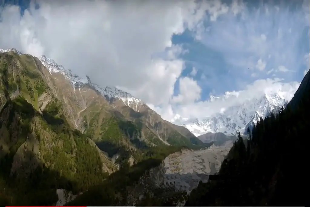
This separate ecoregion covers alpine meadows at high altitudes above the 1500m Sulaiman Mountain Range. The mountains are not high compared to the Himalayas, with peaks rising to around 3,500 m. However, because the area is dry and experiences great temperature extremes, the alpine steppe vegetation descends to low altitudes. Average annual rainfall rarely exceeds 225 mm, while temperatures can see highs over 40 °C in summer and fall to lows of -12 °C in winter.
Biodiversity and Ecosystems of Sulaiman Range
The vegetation in Sulaiman Mountain Range consists mostly of isolated clumps of tussock grasses, thorny tufts of plants such as Onobrychis, a leguminous plant that feeds cattle and the region’s rich community of wild herbivorous mountain sheep and goats. The very name Onobrychis, derived from the Greek for “donkey-eaten”, suggested its value as a nutritious forage plant that sustains wildlife in this ecoregion.
Forest cover is sparse and usually confined to ravines, where streams, seeps, and shade provide some relief from extreme environmental conditions, and to lower elevations where there is more moisture. Forest and forest trees have sclerophyllous leaves: thick and with a waxy surface, an adaptation to retain moisture and reduce water loss in arid environments. Some of the common species include figs, holly oak, Afghan ash and oleander.
The ecoregion of Sulaiman Mountain Range has about fifty species of mammals scattered throughout the territory. Some of the larger, more charismatic species include mountain wild goats and sheep, notably the chiltan markhor, sulaiman markhor, Sind ibex, Ladakh urial and Afghan urial. Large predators include the gray wolf, leopard and brown bear. Smaller mammals and rodents such as collared pika, Royle’s pika and stone marten are widespread in the ecoregion.
More than 150 species of birds have been recorded in this ecoregion, some notable species being the black flamingo, the Eurasian cuckoo, the alpine robin and the European nightingale. The Persian horned viper is a relatively large poisonous snake that can grow up to a meter in length.
These snakes, which hide in rock crevices and wait to ambush prey, are considered “false horned vipers” because the horn-like structures above their eyes are made up of several small scales, unlike true horned vipers, which have horns derived from a single adjusted scale.
The higher elevation areas of the ecoregion are still largely untouched and suitable for wildlife due to sparse human settlements. However, deforestation and human activities, including pastoralism, are common at lower elevations. Cutting down trees for timber is a major threat to habitat, while the capture of bear cubs and leopards by the gypsy tribe as pets and for local circuses threatens these wildlife populations.
The priority conservation measures would therefore be to: 1) secure the areas of Chilghosa pine and Pashtun juniper forests, which are the last remaining in the world, from further encroachment; 2) take steps to prevent the capture and killing of endangered species; and 3) assess the expected impact of climate change on the ecoregion and develop appropriate conservation and adaptation plans.
Geography of Sulaiman Maountain Range
The eastern edge of the Sulaiman Mountain Range runs 280 miles (450 km) from Gomal Pass in Pakistan’s Khyber Pakhtunkhwa province to the city of Jacobabad in Sindh province[6] and continues into southwestern Punjab.
Legends of Takht-e-Sulaiman
One of the highest peaks of the Sulaimans, Takht-i Sulaiman (“Solomon’s Throne”), 3,382 meters (11,096 ft) high, was recorded by Ibn Battuta as Koh-i Sulaiman.
In Pashtun legend, he is associated with the prophet Solomon. According to legend, the Prophet Solomon climbed this mountain and looked around the land of South Asia, which was then covered in darkness, so he turned back without descending to this new frontier, leaving only the mountain that is named after him (as Ibn Battuta).
According to another legend, Noah’s ark came up in Takht-i Sulaiman after the flood.
Another legend says that Qais Abdur Rashid, who is said to be the legendary ancestor of the Pashtun nation, is buried at the top of Takht-e-Sulaiman, hence it is also known locally as Da Kasī Ghar (“Mountain of Qais”).