The city is blessed with plenty of greenery and natural beauty. This includes hiking trails in Islamabad starting from the foothills of beautiful Margalla Hills and ending at the Top.
Note: Smart Watch will help you to monitor your hiking performance, speed, Heart rate, etc.
Hiking Trails in Islamabad
Hiking Trail 1
Trail 1 starts at Margalla Hills behind Sector E-8 and E-9 Islamabad. It will take you to Pir Sohawa Highway, in around two hours.
Hiking Trail – 2 (ZOO TO DAMN – E – KOH)
A simple hiking trail, this is great for families and starts just outside Pir Sohawa Street, or behind the Islamabad Zoo. It ends up at Daman-e-Koh, a relatively easy hiking track. Daman e Koh offers attractions such as playgrounds, street food, and Chai Wallas.
It is a popular tourist destination and is usually easy to catch a cab on the way to the bottom, once you are done for the day hiking. Daman-e-Koh also links mountain trails with a cactus ridge that crosses other hilly routes. It is a One to 1.5 walk and leads you to a viewing point of Daman-e-Koh. The track does not end at Damn-e-Koh and has an extension over Cactus Ridge. The top of Cactus Ridge offers beautiful scenery and landscape of Islamabad.
Trail 2 leading to Damn-e-Koh is the shortest route. It would be a good choice if one wants to go up for a short Sunday with the family. It has two separate route heads. The first is found on the small dirt track beside Marghazar Zoo. Alternatively, there is a well-marked track at the beginning of Pir Sohawa Road, a short distance from the Trail-4 parking lot.
Hiking Trail – 3 (SECTOR F-6)
Trail 3 is one of the adventurous, healthy, and challenging hiking trails of the Margalla Hills of Islamabad. It is a great place to kick-start hiking with kids. Trail 3 keeps you active throughout the trip, while the kids can take a short break at a variety of beautiful wooden benches. A large number of locals and foreigners enjoy walking every day on this track. Whenever you visit Islamabad, it is recommended that you visit this trail.
It is also one of the longest hiking trails in Islamabad. Parking is available at the Trail 3 starting point. The first route up the hill is steep and takes more than half an hour of moderate walking to reach View Point. ‘Viewpoint offers a beautiful view of Islamabad and almost all the great buildings, monuments, and paths are visible to the naked eye from here.
For many mountain-clad families, ViewPoint marks the finishing point of the Trail-3. For those who are more enthusiastic, however, it is only one-third of the journey.
The trail passes through the trees and constantly climbs. It is recommended that you carry water bottles during the hike. Throughout Trail 3, the benches lie in the right places to rest, a splendor that is not found in any other routes.
From the middle of the trek, it takes about an hour on foot to reach the Finish Line near Pir Sohawa Road. Due to its easy availability, proper marking, proper rest areas, proper cleaning methods, and better care, hiking to trail-3 is the most popular option for pedestrians of all ages.
The trail is somewhat tedious, due to the steep hills, but every time you go up this trail it will feel like a new adventure. There are 2 ways to reach on top through this path.
One is straight and is also called the fire trail, which is steep and exhausting. New bees are not recommended. Otherwise, it takes less time to reach the top.
The other is a common hiking trail, a zigzag path, and very easy for all ages without a few hikes. The track is surrounded by nature all the trees and flowers, monkeys, and other small animals but there is no danger. Nature is soothing and refreshing with its cool breath of fresh air.
There are no convenience stores or cafes when going up, so it is best to have some water/juice bottles for easy access before you start climbing. Sometimes along the way, one can find a few vendors selling drinks, biscuits, and snacks. In all, it takes about 90 minutes to reach the top.
Hiking Trail – 3b
This is the subsidiary trail that starts a little ahead of trail 3 on the left. The Route is narrower than trail 3 and usually fewer people travel on this trail as it can mostly be driven before or used for hiking. But if you are not afraid of the forest and peace, then you should go.
At first, it follows a completely different route and then Trail 3 but after about 2.4km you will cross main Trail 3, two or three times. Being alone if you want to enjoy nature, good views, and some music, is a great way to hike to try.
Hiking Trail – 4 (Dhoke GEEEVAN LOOP)
It is a link between hiking Trails 3 and 5. If you want to travel long distances with panoramic views, this amazing Trail 4 is for you. Smooth in the hills and home in the beautiful scenery from the hills, this trail is ideal for those who want to extend their travel time and immerse themselves in the hills for a day of active travel.
The route comes from a La Montana restaurant on the left, about a mile from Marghzar Zoo. Leaving the first turn on left about 300 meters from the parking lot, the trail runs along Pir Sohawa Road and then turns right onto the Dhok Jeevan Loop Trail.
In Dhok Jeevan Loop, you have to stay on the path from the parking lot as described above to the small washable concrete pool 3 meters high and 20 meters wide. From here the trail goes up to Pir Sohawa Road where the hairpins are bent.
To stay on the trail and not go the right way up the road, you will go down a gorge, cross a river, and climb slowly. Leaving the right-hand lane that will take you to Pir Sohawa Road about a mile more, you will pass a small spring, cross the valley, and join Trail 4 at the top of the trip as described above.
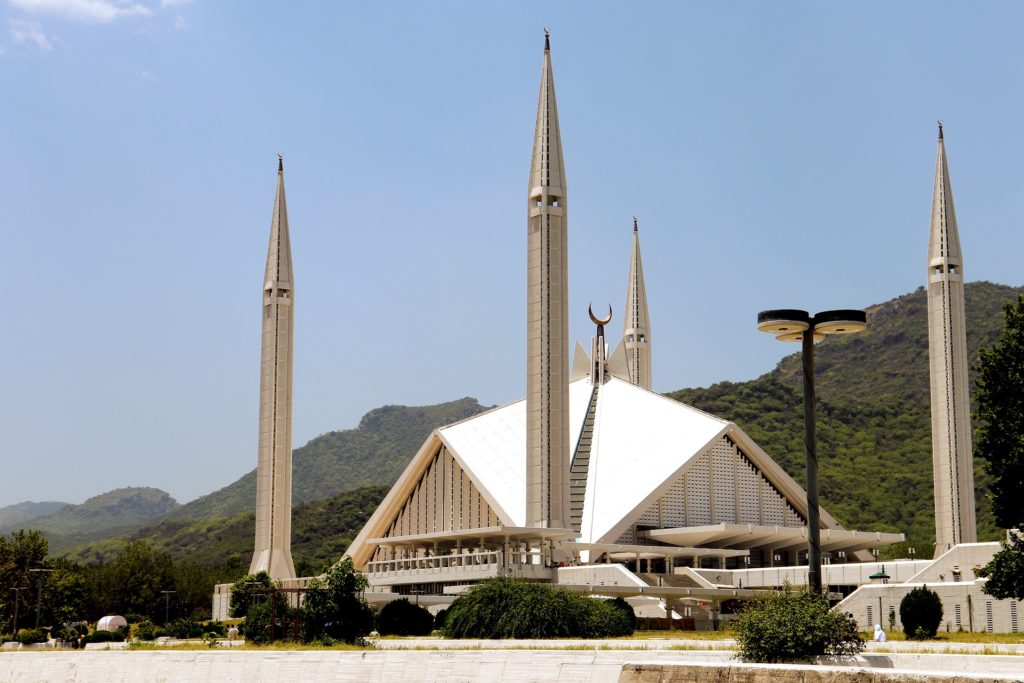
From here you can get off at hiking Trail 4 and return to the car park, cross the Chak Jabbi and Faisal Mosque, or turn right onto Trail 4 and end at Pir Sohawa Road.
Hiking Trail – 5 (DARRA JANGLA OR DARA JANGLAN)
Hiking Trail 5 lies in the village of Darra Jangla or Dara Janglan, half a mile after Trail 3, and is one of the busiest and most peaceful hiking trails in the National Park. This path starts at the northern end of Margalla Road in the F-5 Sector, and people find it easy to climb and connect with Trail 3. Hiking Trails 3 and 5 run parallel to a certain distance and are connected by Route 4 in some places.
This hiking trail in Islamabad is also very popular among foreigners. Tourist centers are located at the entrance to the valley and include a car park, a large forest nursery, an educational center, picnic areas, and a camping site. In addition, at the beginning of the trail, there is a tourist information center that can guide travelers along the route.
Previously it was not open for the general public due to security concerns, but now it can be visited.
The first point is located a few hundred meters ahead of Trail-3 in relation to Category F-5 on Margallah Road. A few meters after the start, a stream of water welcomes you. One crosses several streams of fresh water during the hiking. Initially, the stream flows along a trail which makes it very enjoyable and in the middle, the new water fountain provides a good resting place for travelers.
The second part of the Trail-5 involves much intense and serious hiking. Above, it offers beautiful vistas of the city of Islamabad and finishes near a post-security checkpoint on Pir Sohawa Road. About 500 m west of the main road leading west leads to the Monal Restaurant. The Trail is difficult and is recommended for families up to ‘Ficus Spring’ only. It is not recommended to trek in the evening during the day.
The trail runs through dense jungle and the entire trail has a solid wooden frame and any deviation from the main trail can cause you to get lost in the forest. There are no mobile signs for a few points on the track. Travelers are advised to carry a stick, a torch, water, and something to eat with them.
Trail 5 will take you to the top of Pir Sohawa Road. You can change between hiking trails, 3 to 5 by traveling an additional distance of 1.5 Kms. The estimated time to cover the distance on the way is about 2.5-3.5 hours.
Hiking Trail – 6 (RIDGE TRAIL)
Trail 6 can be accessed from the parking lot located behind the Faisal Masjid in Sector E-7, Islamabad. The trek is quite easy for the first 1/2 mile and you have to walk through dense jungles and enjoy the stream along the trail. After that, the trail is hard and rough. This is one of the best hiking trails in the middle of greenery and nature. It will take 3-4 hours to travel the full route. If you can travel long distances, this place is for you.
At first, the trail is flat but eventually, it will take you to the top of the Margalla up the hill. This trail is wonderfully maintained and kept clean.
There was a stream of water on Trail 6 that enhanced the beauty of the track, but is now dry for a few years. The trails will take you to a village near a well-defined trail that leads you to the main road of Pir Sohawa. The trail has a mountain bike track and a point for birdwatching.
The village north of the local Faisal Mosque is also known as the Darra Kavani.Trail-6 or Chak Jabbi Trail is one of the latest hiking trails that has been officially adopted and opened to the general public. It is about 4km long and leads up to the Village Jabbi.
This hiking trail grows slowly and passes through dense forest. Half an hour from the start, it takes you to a beautiful water fountain with dates and palm trees all around you. The upper part of the road consists of a hill and reaches the small village of Jabbi about 4 km from the Faisal Mosque.
Going north along the route takes you to the hill known as Budho Ban where you can choose to return, turn west onto the Ridge Trail into another valley and descend, or turn east and continue on the Ridge Train until you reach Pir Sohawa Road.
The trail is surrounded by a rich green area suitable for mental and physical health. You should not forget to take enough water and other fruits for a little hunger and wear a run for easy walking shoes. Please keep the route clean during trekking.
This route is used sparingly as the door is unknown to most people. It also connects to the nearby Trail-4 and leads to a parking lot on the Pir Sohwa Road. The Trail is properly marked, well maintained, and can be done with the family in about 3 hours from start to finish.
This track runs along the top of the first ridge in the hills overlooking Islamabad. The Ridge Trail starts at Boulder Pass (Kot Ban) and ends at Pir Sohawa Road. The length of the road is about 8 km and it takes four to five hours to reach Pir Sohawa Road from Kot Ban.
This climb begins at the small cemetery where the trail goes up the steep slope and continues on the north side towards Khyber Pakhtunkhwa passing through an olive tree on a seat with many ruined houses full of fig trees. It follows the ridge on the north side to the head of the Kalinjher Valley and continues on the south side of the hill towards Islamabad, partially along the skull to Pir Sohawa Road.
The Asiatic Leopard Conservation Zone was established earlier this year by the Islamabad Wildlife Board (IWMB) to protect and conserve a number of Asiatic leopards that were recently spotted along Trail 6 in the Margalla Hills.
Darra Kalinjer
This route starts behind Sectors E-8 and E-9 and has a few connected routes. The easiest route to the head of the track is from Kalinjer village near Margallah Hills from the Agha Shahi Avenue interchange on the E-8 (Pakistan Navy) and E-9 (Pakistan Air Force) divisions.
Visitors are required to present their identity documents to security personnel, and immigrants are not permitted. Hiking can be started from a small mazar in Kalinjer village. Alternatively, you can take the track west from the Trail 6 Visitor Information Center at Faisal Mosque and walk through the fence of the Navy Golf Course to the villages of Gandhian and Kalinjer.
From the Kalinjer valley, the trail initially runs through a river of water leading to the mountains. After the flow arises from the dam, the trail goes up and takes it to the Y center in Panryas (spring). The track on the right goes up to Loran di Gali where it joins the track at the station from Gandhian.
If you take the track to the left, you come to Kalinjer Gali, where you can turn east to reach View Point (Old CDA fire picket). From here you can look down at the Kalinjer and Sanyari valleys at the same time. To the north is Khyber Pakhtoonkhwa.
From here you can turn West and up to Sandhuri from there following the Ridge Trail to Boulder Pass; take the road down to Sanyari Valley; follow the Link Trail to Boulder Pass (Kot Ban) and walk down or get your driver to pick up the car and drive down to Balimah; or go east and follow the track on West Ridge to Pir Sohawa Road.
You can go down to Sanyari Valley, where the trail ends in the Sanyari valley near the famous Banyan Trees. From here a meter-high road leads to the exit of Margallah Highway, towards F-9 Park.
New Hiking Trail 7 in Islamabad
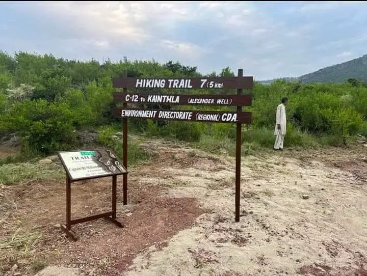
Capital Development Authority (CDA Environment Wing) of Islamabad unveiled a new hiking trail named Hiking Trail 7 in the Margalla Hills of Islamabad for tourists and visitors on 23rd August 2022.
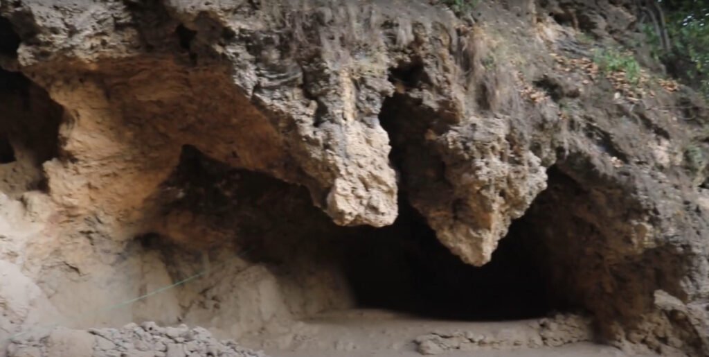
The Inauguration of Trail 7 in Islamabad takes place on August 23, 2022 at 6 AM. Hiking Trail 7 will start at Sector C-12 (Shah ALLAH Ditta, Islamabad) to Kainthia Village, (Alexander Well) with a total distance of 5 km.