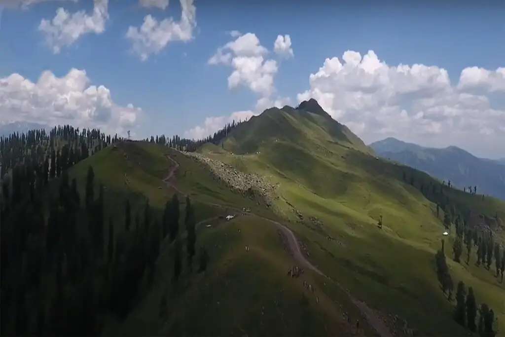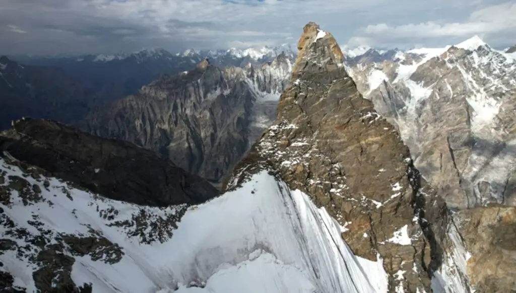
Laila Peak is a mountain in the Hushe Valley near the Gondogoro Glacier in the Karakoram Mountains. Located in Gilgit-Baltistan, Pakistan, Laila Peak has a distinct lance-shaped shape and its northwest face slopes 45 degrees in more than 1,500 vertical meters.
Height of Laila Peak
The height of Laila Peak in the Hushe Valley is controversial. Some believe it to be 6,200 meters, while some list it as 6,614 meters. In the Japanese Mountaineering Map by Tsuneo Miyamori (published in 2003), the height of Laila Peak is mentioned as 6096 meters.
How do I get to Laila Peak?
Laila Peak can be climbed in fewer days from the advanced base camp (5765m), on the east side of the Gondogoro Glacier, with an ascent of approximately 1500 meters, the climbing is medium class with a gradient of 55 degrees. The lower part of the climb is mixed with more ice gradually receding towards the top.
Laila Peak (also spelled Leyla or Lila Peak) is one of the most beautiful mountains in Pakistan – if not the world, with a peak forming a perfect needle shape. The peak is synonymous with its western face, which descends from the mountains at an almost uniform slope, forming a giant ramp.
Its northern and eastern sides are made up of contrasting steep granite. The mountain is located east of the Gondogoro Valley and west of the Chogolisa Valley in the Masherbrum Range of Baltistan. Most people have seen the summit after crossing Gondogoro La from Concordia Base Camp and K2.
First Ascent to Laila Peak
Like many peaks of this height in the Karakoram conquered in the 1980s and 1990s, the first ascents were made illegally without proper permits. Climbs therefore received limited initial recognition. The first ascent was made by a four-man British team including Simon Yates, Sean Smith, and Mark Miller, who ascended the summit in 1987 via the west face of the Gondogoro Glacier.
This was Simon Yates’ first major ascent since the Siula Grande epic in 1985. Although technically an “unofficial” ascent, it became as official as any “official” ascent when Simon Yates dedicated a chapter of his biographical book, “Flame of Adventure” when climbing. This included a number of excellent photographs of the ascent. The group continued with the first ascent of nearby Nemek (6400 m).
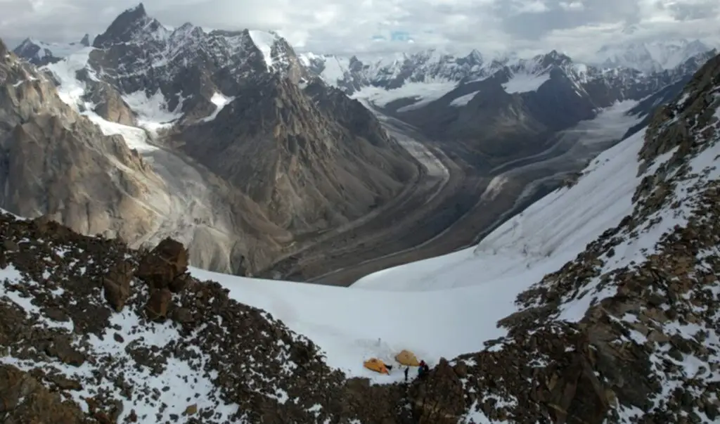
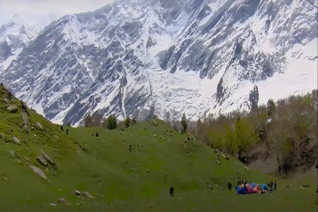
All ascents to Laila Peak were done in alpine style. From the advanced base camp on the eastern side of the Gondogoro Glacier, a strong group can climb the mountain in a single day. With an elevation gain of around 1500m, many people decide to bivouac on the route, then summit and descend the next day.
The climbing is of medium class with a maximum slope of 55 degrees. The lower part of the climb is mixed with more ice gradually receding towards the top. The easy nearby peak of Gondogoro (5650 m) can be used for acclimatization if necessary.
Fredrik Ericsson and Jörgen Aamot also skied the summit of Laila Peak. It was the first ski run on the mountain. The pair did not actually climb to the top of the mountain and stopped 120 to 140 meters away. The icy conditions at the very top would be suicidal to ski down. After descending from Laila, they disembarked and skied down Gasherbrum II.
No permit or liaison officer is currently required to climb Laila Peak as it is less than 6,500 m. The Pakistan Ministry of Tourism raised the threshold height permit requirements from 6,000 m to 6,500 m after 9/11 in hopes of attracting climbers, but again to Pakistan. All climbs described in the overview therefore required a climbing permit. There will be no changes to the current policy for 2009.
The mountain falls into a “restricted zone”. No-go zones are areas relatively close to border areas (ie India, China, and Afghanistan). The village of Hushe, which is the gateway to the mountain, is in the open, as is the valley of Masherbrum to the west of Laila. However, the valleys of Gondogoro and Chogolisa are limited, making the climb to the top significantly more expensive.
To visit these valleys, you must purchase a permit from the Ministry of Tourism ($50 per person), hire a licensed guide, and take out personal accident insurance for the guide (guide) and porters. A wizard is required at all times, although he does little at base. There are mountain guides in Pakistan, but few of them are good by Western standards (probably the wrong mountain to climb if you want a guided climb anyway).
One member must attend a mandatory briefing and debriefing at the Ministry of Tourism in Islamabad as well as a debriefing. Some people skip the debriefing, even though it reflects poorly on the associate guide who relies on the Ministry of Tourism to issue the license. Most people use a trekking company in Pakistan to provide a licensed guide, deal with red tape, and make all the arrangements.
The above requirements apply only to foreigners. Pakistanis who are not from the northern areas can easily visit the area without a permit. There are no checkpoints beyond Hushe, so parties in the past have found it easy to enter the valley without proper paperwork.
There are actually three Laila peaks in Pakistan to add to the confusion. “Laila” means “dearest or most beloved” in the local language. The highest is located on the southern side of the Chogo Lungma Glacier in the Haramosh Mountains. It is not far from Spantik, which is popular with commercial expeditions.
Laila Peak is difficult to climb, and since it is 6986m, a permit is required to climb it. The smallest Laila is on the southern side of the Rupal valley in the far western Himalayas. The summit is only 5971m but still a nice peak to climb. It does not require a climbing permit, as is the case with the Laila peak listed.
How do I get to Laila Peak?
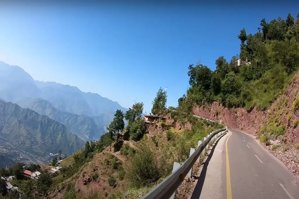
Laila Peak has a remote location in the heart of Central Karakoram but is relatively easily accessible from the village of Hushe, which is itself connected by road to Skardu. Private jeeps travel between Skardu and Hushe in approximately eight hours. As the Gondogoro and Chogolisa valleys are restricted, most people, climbing this peak will travel by private jeep between Skardu and Hushe with a trekking company. This is usually unavoidable as passenger jeeps are not usually equipped to carry expedition cargo in addition to other passengers’ luggage.
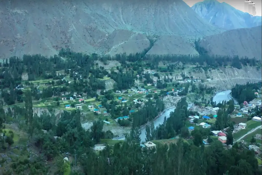
From Hushe village you can reach the mountain in about two days, but unacclimatized parties may take longer to gain altitude more slowly (base camp is at 4680m, while Hushe is only at 3050m). The route is easy to navigate as numerous hiking groups descend the valley as the finale of the K2 trek. Porters can easily be arranged in Hush. The route initially follows the right-left bank of the Hushe River to the north.
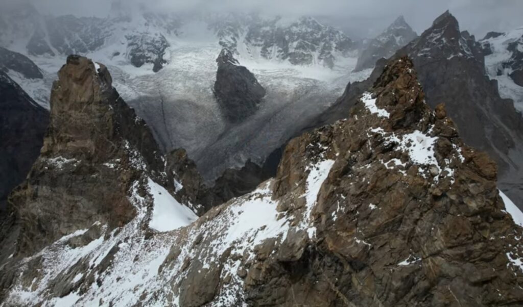
After a few hours, the trail emerged to the northeast along the confluence of the Gondogoro and Tsarak rivers. Shaishcho is reached an hour later. East of here is the Charakusa (or Tsarak Tsa) Valley, which is famous for its exceptional rock climbing. From Shaishcho, the Gondogoro Valley begins, with the trail climbing steeply at first. The Gondogoro Glacier can be followed along its right-left bank for a large part of the way, but its right-right height must be overcome. The glacier crossing is easy enough for any climber with glacier experience.
Laila Peak can also be reached via Gondogoro La. This would be an expensive, time-consuming way to get to the mountain, but a fantastic trek over the Baltoro Glacier and Concordia.
Trekking groups crossing Gondogoro La from Concordia usually take only a few porters over the pass due to the number of those leaving Askole at the start of the trek, as most of the food has been used up by then. With the addition of Laila Peak to the itinerary, significantly more porters will be required to cross the pass into the Gondogoro Valley, adding to the overall cost. Corax has more information about crossing the pass on their Gasherbrum I page. It’s not too difficult, but has some of the best views of any pass in Pakistan.